Projects: Innovation
OPERATION AND MAINTENANCE BIM MODEL OF MAMARIGA ROAD TUNNELS
SERVICES FOR THE DEVELOPMENT OF THE BIM (BUILDING INFORMATION MODELLING) MODEL FOR THE WORKS OPERATION FOR THE MAMARIGA TUNNELS UPDATED ON THE N-644 ROAD.
Repositorio con un modelo BIM centralizado
Area of activity
INNOVATION
Service
–
Client
INTERBIAK Bizkaia- Bizkaia Infrastructure Agency
Scope
- Development of BIM model of operation
- Laser scanning of the two tunnels inside
Duration
2019
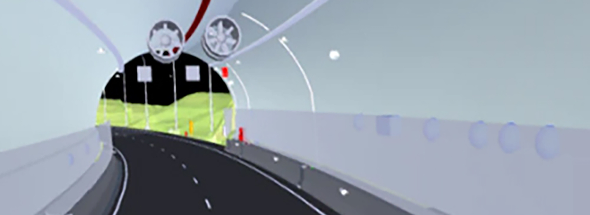
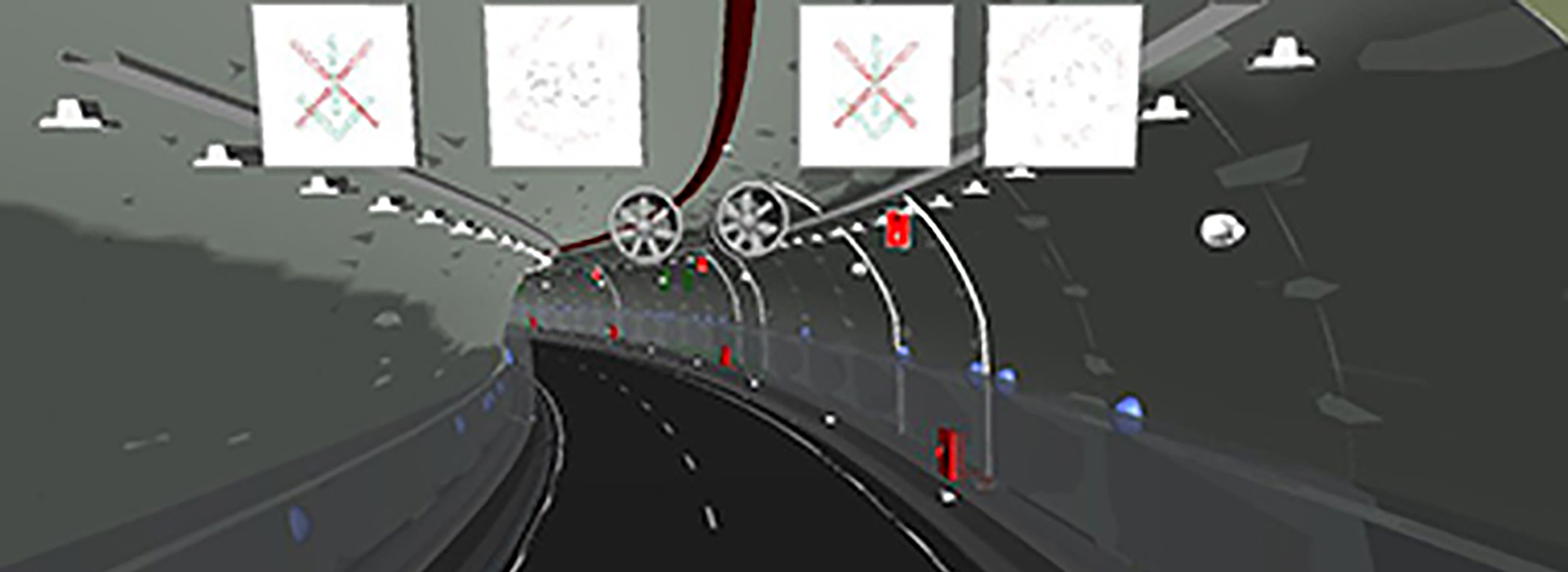
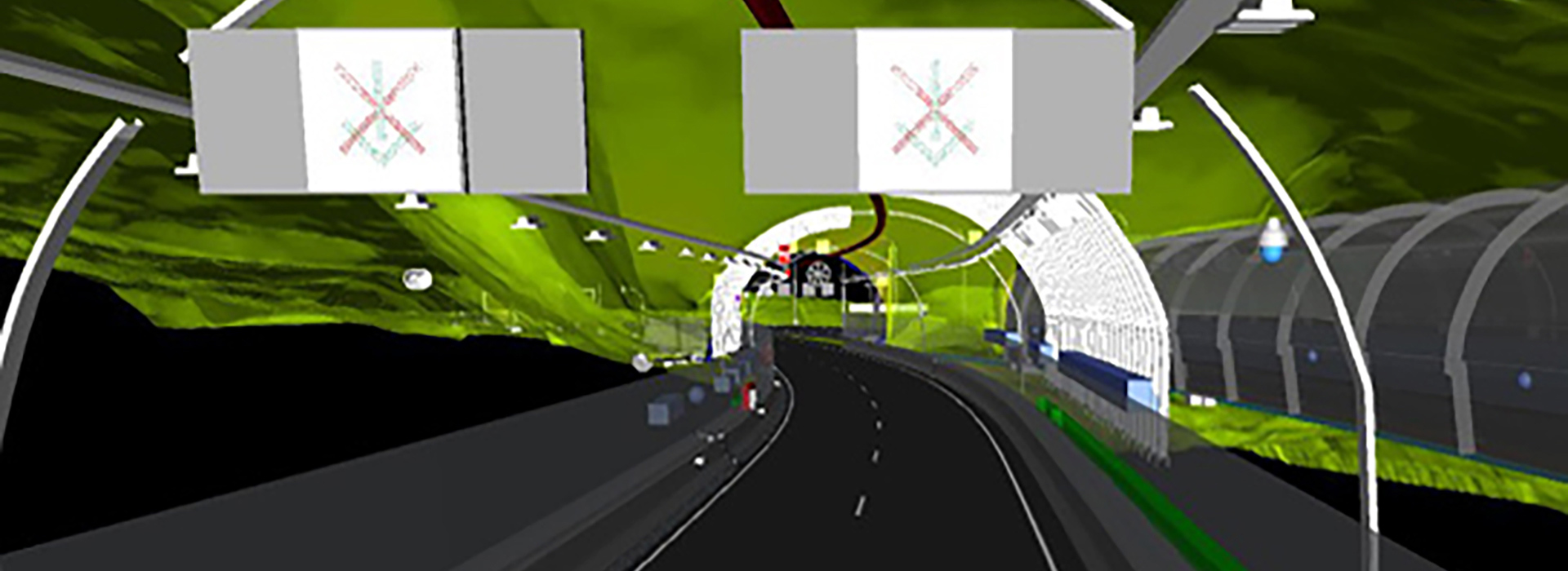
The Mamariga tunnels renovation project was planned with a clear focus on regulatory compliance, as well as the creation of a basic infrastructure and safety superstructure. In infrastructure, the works to be carried out included section widening, drainage improvements, safety barriers, aesthetic lining and agglomeration. In the superstructure, the intervention focused on the electrical power system, lighting, ventilation, PCI system, SVC systems and communications.
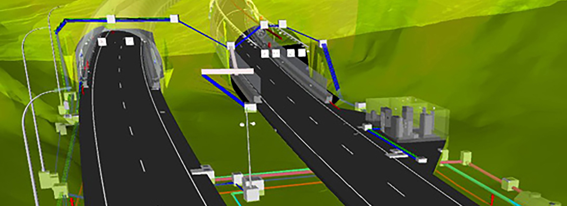
The works started to be executed at the end of 2018 and in its elaboration a significant amount of technical documentation was developed and organized in a digital repository called As Built Library. The challenge in this project was the creation of this repository and that it could be accessible, organized and collaborative in a dynamic and intuitive way.
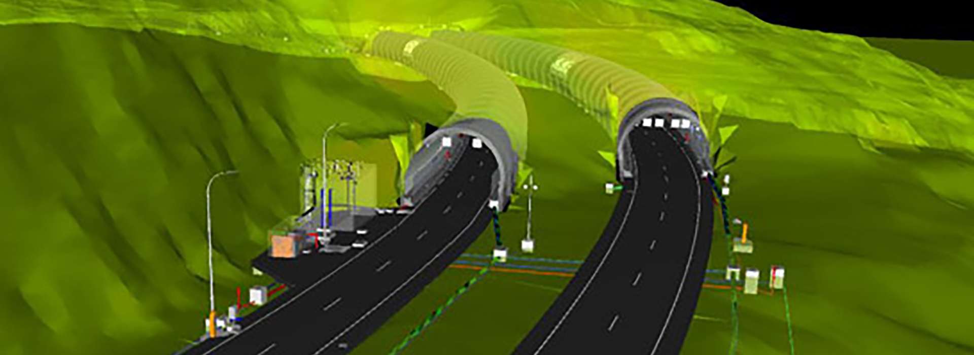
To create the repository, a centralized BIM model was used, in which all the elements that were executed on site were represented. The premise of being accessible, both in terms of information and graphics as well as data, was maintained, which represents one of the great advantages of using this methodology. To achieve this, initial models were created with information on the terrain, the outer roadway and the interior shape of the tunnel. Afterwards, 16 other specific models were developed for the different disciplines. Finally, a different model was created for the real section of the tunnels at the end of the work, based on sections measured every 10 m and joined together to create a single solid.
Specialized software such as Civil 3D, Revit and Dynamo were used to create the tunnel model. The axes of the roadways and their XYZ coordinates were defined with the former. In Revit, the tunnel sections were created and linked to the Civil 3D data. Finally, Dynamo was used to visually program scripts to locate the different elements that make up the tunnel along the axis (linear structures, barriers, real section, pipelines, etc.) automatically by reading the location information from Excel files.
Once all the elements were modelled and organized, aspects such as their names, position, geometry or materials were defined. The next step was to visualize all these components in a single federated model. Thus, the information of the different models could be observed simultaneously in a graphical and very practical way.
Finally, the As Built Library was linked to the model, producing two hyperlinks: one for the Specific Documentation and one for the Planimetric Documentation. In addition, the General Documentation of the project was also linked through an information matrix within the same model. The federated model with all the project documentation can be visualized in Navisworks Freedom.