Projects: Environment
STRATEGIC ENVIRONMENTAL ASSESSMENT OF THE BI-631 ROAD RECTIFICATION
STRATEGIC ENVIRONMENTAL ASSESSMENT OF THE SPECIAL PLAN FOR THE RECTIFICATION OF THE LAYOUT AND WIDENING OF THE BI-631 ROAD.
Introducing the environmental variable into decision-making on plans and programmes
Area of activity
WATER AND ENVIRONMENT
Service
Environment and biodiversity
Client
INTERBIAK Bizkaia- Bizkaia Agency of Infrastructures
Scope
- Initial strategic document
- Initiation application for the of the Strategic Environmental Assessment
- Special Road Plan development
Duration
2018-2019
The strategic environmental assessment is an administrative procedure for the approval or adoption of plans and programs, through which their possible significant effects on the environment are analyzed. By means of this instrument, the environmental variable is introduced into the decision-making process on plans and programs with a significant impact on the environment. It is carried out from the early stages of their preparation and before their adoption, with a view to promoting sustainable development.
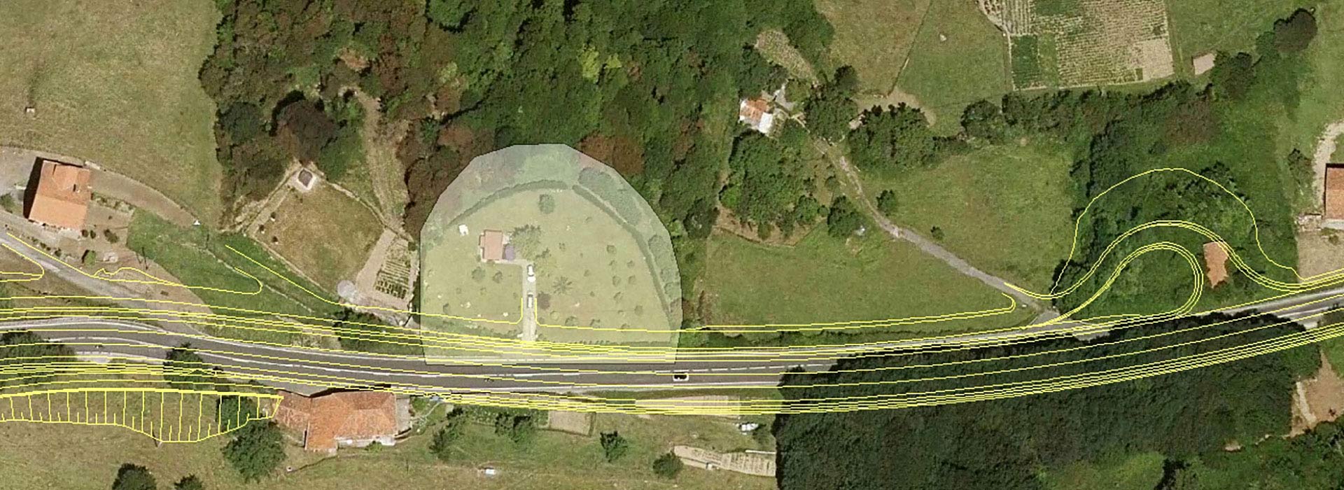
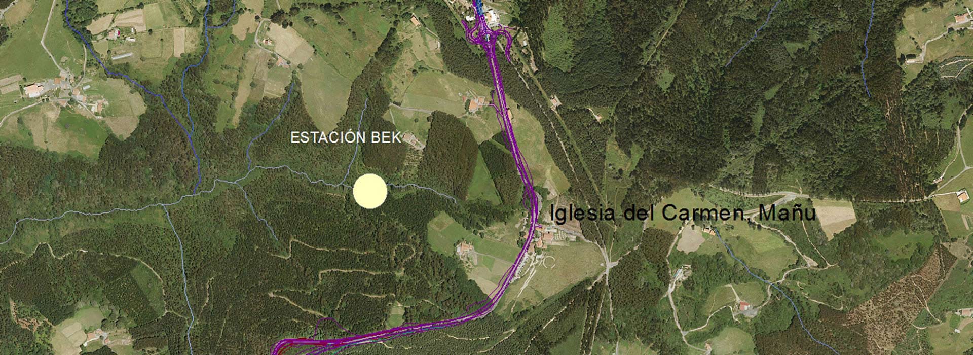
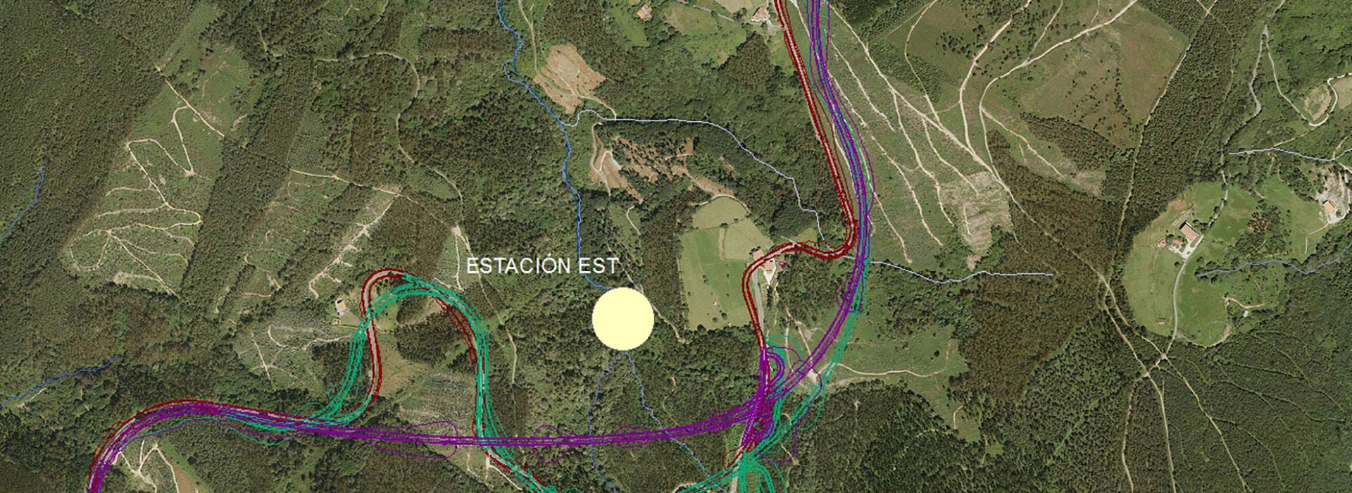
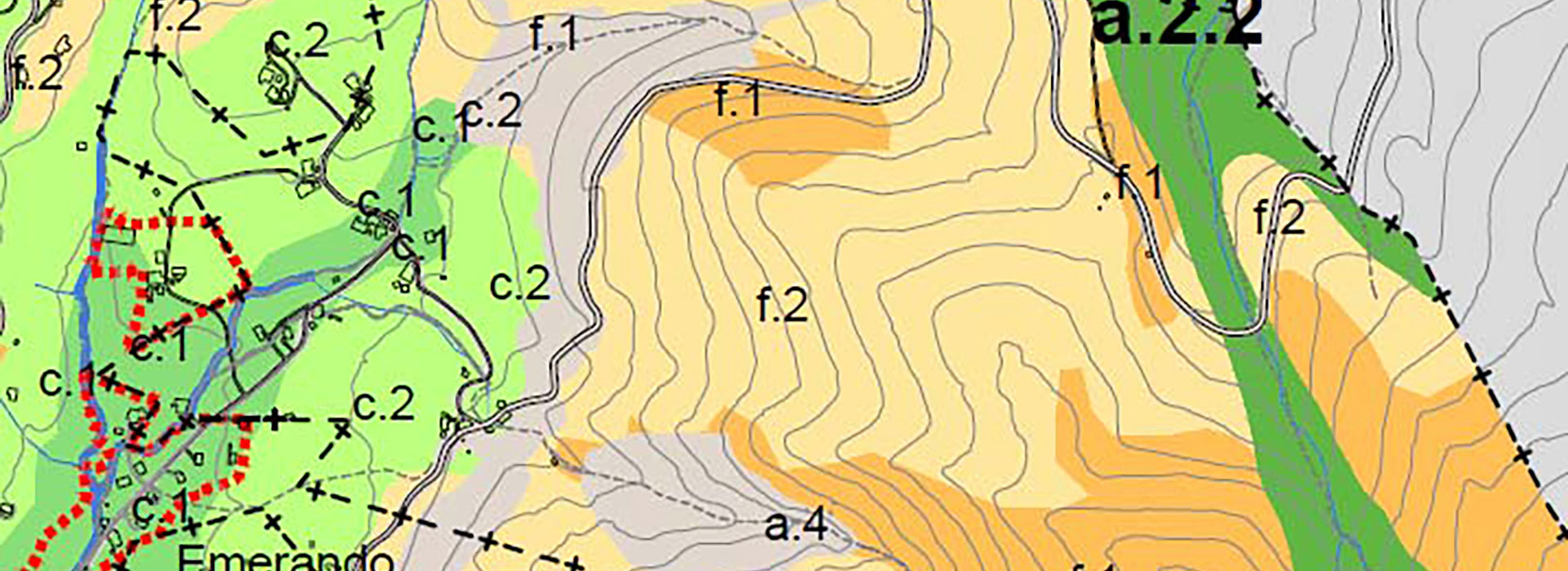
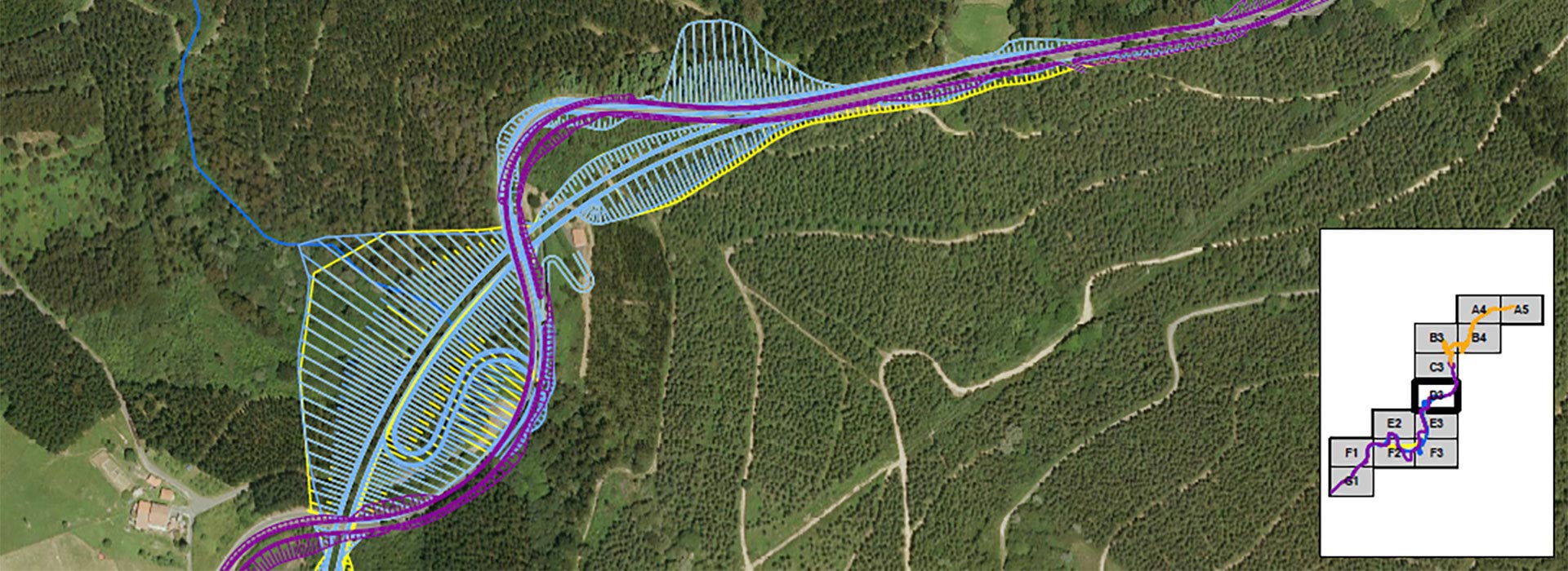
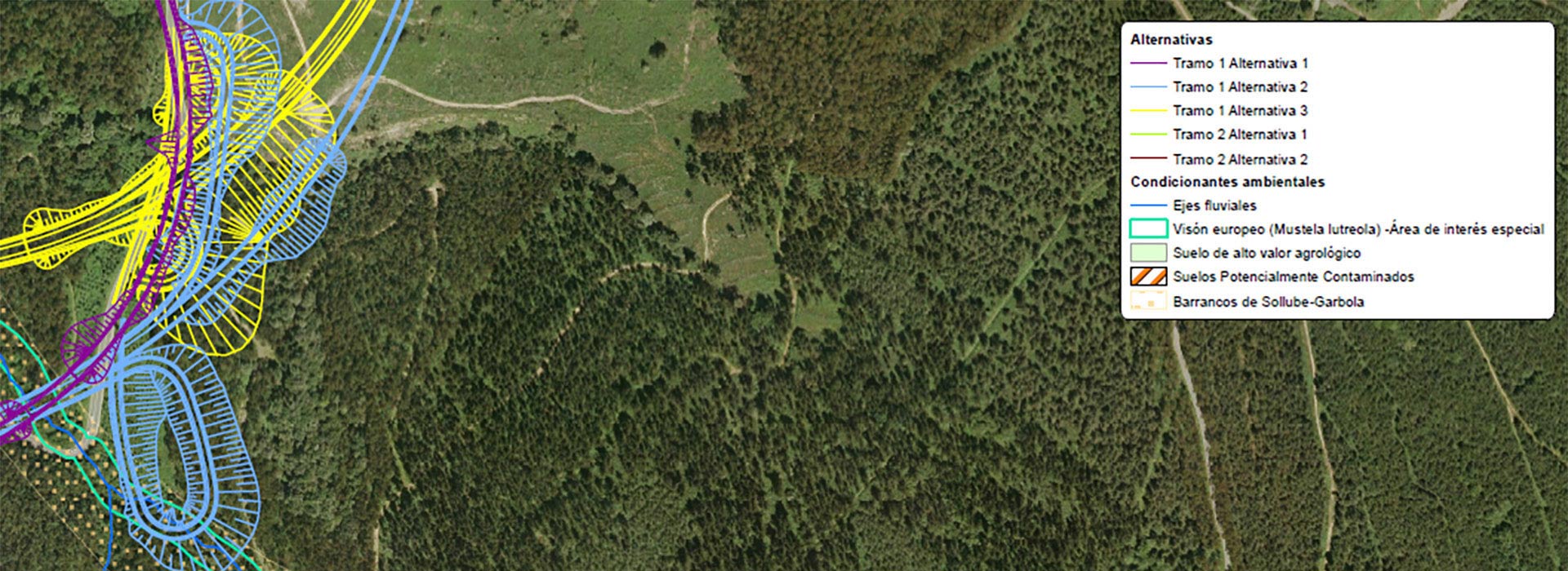
The submission to ordinary strategic environmental assessment of the Special Road Plan for the rectification of the layout and widening of the BI-631 road is based on the fact that it is a plan that may affect a space protected by international agreements in application of the basic legislation on natural heritage and biodiversity, such as the Urdaibai Biosphere Reserve.
The BI-631 road connects the municipality of Bilbao with Bermeo through the Sollube pass. In the section between the Derio junction and the airport access junction, the road belongs to the red network and is now called the N-633 road. From the airport junction, it is renamed BI-631. From this junction to the Mungia traffic circle (Mungia By-pass), it is a dual carriageway with two lanes in each direction.
This section ends at a traffic circle that connects, in addition to the BI-2121 road (to Gernika), with a municipal access road to the urban area of Mungia. From the traffic circle to Bermeo, the road has a single carriageway with one lane in each direction, except in some sections where there is an additional lane for slow vehicles.
The reason for the drafting of the TAP was that the proposed route affected the Urdaibai Biosphere Reserve, and therefore, according to the then current Master Plan for Use and Management, it was mandatory to carry out a Territorial Action Plan aimed at providing the infrastructure and services (general systems of urban planning legislation) necessary for the development of the territory.